
Pinal County Neighbors by Source
Block research begins with the official record that matches the question. The parcel viewer shows the legal lots around one point. The Assessor identifies recorded owners and separates the physical site from the postal address. Treasurer data adds a tax account and an owner mailing search. Civic groups can supply public contacts, but their lists are not government rolls. Pinal County neighbors who rent, share a home, or simply do not appear in a public filing may remain invisible.
| Source | What It Shows About a Block | Access |
|---|---|---|
| Assessor Parcel Viewer | Parcel lines, site address, owner, subdivision, nearby lots | Free interactive map; lines are illustrative |
| Assessor and Treasurer rolls | Owner, separate mailing address, tax account, parcel facts | Free; Treasurer updates nightly |
| Recorder instruments | Named parties, deeds, plats, legal continuity | Online images from May 23, 1980 |
| Voter records | Controlled registration data for permitted purposes | Self portal is not a block directory |
| Community organizations | Public group and civic contact points | Published contacts or voluntary access |
| Historical directories | Earlier subscriber or householder clues | Title-specific library and archive access |
An owner name proves that the assessment roll connects a person or entity to a parcel. It does not prove occupancy, family ties, or who is present now. An association may own a common area. A trust or company may hold a home. A postal address may lead to a management office, another property, or a post office box. Keep each fact in its stated role.
Selecting Pinal County Neighbor Parcels
The Pinal County Assessor Parcel Viewer searches a parcel number, site address, or first and second owner names. Start with one exact site address. The parcel popup can expose the parcel number, owners, postal address, legal description, subdivision, land area, districts, property class, building facts, sale details, and reception number.
The map has point, rectangle, polygon, circle, and polyline selection. It does not have an enabled one-click buffer. Draw a shape around the visible block and review each result. Because intersecting parcels can be included, edge lots may merely touch the selected shape. Discard those after checking the map. Layers for structures, lot lines, surveys, subdivisions, streets, townships, sections, cities, zoning, flood areas, and districts add context.
Print and measure tools can document research, but county lines are illustrative. Fences and mapped boundaries may disagree. A recorded survey and title evidence control where a legal boundary matters.
Map quirk. Use a rectangle, polygon, or circle to build the local group by hand; the Pinal viewer has no active automatic radius tool.
Map Pinal County Neighbors
A short process keeps the block study tied to land records. Work outward from one known site, not from a list of names. Record official labels exactly before trying to normalize road suffixes, directionals, or postal city names.
- Search the site address and choose the matching Site Address suggestion. Save its parcel number and legal description.
- Zoom until parcel outlines and street labels are clear. Draw a tight shape around the intended lots.
- Open each parcel. Capture its site address, recorded owner, separate postal address, subdivision, and reception number.
- Check the classic Assessor or Treasurer by parcel number. Treat nightly tax data as a cross-check, not a live occupancy list.
- Use the reception number in the Recorder index when ownership history matters. Keep names of entities and trusts as recorded.
This flow studies only the immediate block. A longer route and its deed chain belong in the Pinal County street directory. That distinction prevents a local neighbor inquiry from becoming an unfocused countywide name search.
Pinal County Neighbor Geography
Pinal County does not have one city scheme. A block can sit in an incorporated municipality, an unincorporated community, or near tribal land. Postal labels do not settle jurisdiction. San Tan Valley, for example, is unincorporated, while Queen Creek reaches partly into Pinal County. County GIS and its Cities and Towns layer should resolve which public body keeps permits, code records, and civic information.
Five county addressing grids also shape rural addresses. Apache Junction, Casa Grande, Eloy, Florence, and Coolidge origins govern different regions, while cities that administer their own addressing use their own systems. Tribal governments remain sovereign custodians. County Assessor or Recorder data do not replace records held by Gila River, Ak-Chin, Tohono O'odham, San Carlos Apache, or other tribal authorities.
A road crossing a municipal line may require two permit requests. A ZIP label can cross county lines. District layers may describe representation, schools, or services, but none is a roll of households. Geography tells the researcher which office to ask, not who lives behind each door.
Note: Resolve city, county, postal, and tribal layers separately before assigning any block record to the office that created it.
Pinal County Community Contacts
No official countywide HOA or member roster was located. Pinal County's community-organization material instead points to incorporated towns, unincorporated communities, tribal nations, libraries, and regional groups. Those resources can identify a public contact, meeting notice, local archive, or voluntary association. They should not be described as resident directories.
County community listings
Use Pinal County to identify public channels for Arizona City, Gold Canyon, Oracle, San Manuel, San Tan Valley, and other unincorporated areas.
Municipal clerks
Ask the correct city for public boards, local permits, meeting records, and published neighborhood contacts after confirming jurisdiction.
Library branches
The Pinal County Library District links member branches whose catalogs, yearbooks, newspapers, and reference desks may preserve local context.
Private associations
HOA, congregation, club, and block-watch lists are voluntary or private unless the organization itself publishes a contact.
If the parcel owner is an association or company, the Arizona Corporation Commission Entity Search may confirm its public statutory agent, principal, entity number, status, county, and filing address. It does not identify nearby residents.
Open the official Arizona entity search before using the assigned interface capture.
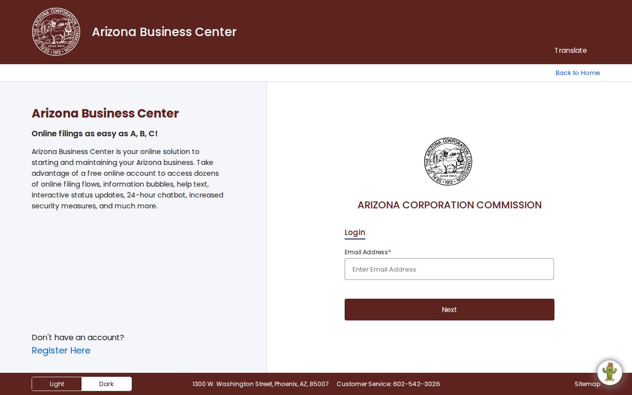
The form is useful when a common-area parcel belongs to a legal entity, while its business address must not be recast as a neighbor's home.
Pinal County Neighbor Address Types
The Assessor's site address describes the parcel's physical location. Its postal fields describe where owner mail goes. The Treasurer's owner search can filter that mailing ZIP and export results, while GIS works from the physical site. The two systems answer different questions. A mismatch can reflect a post office box, second property, management address, or an older roll.
- Site or situs address
- The physical location county records assign to the parcel.
- Owner mailing address
- The destination used for assessment or tax mail, which may be elsewhere.
- Parcel
- A mapped unit of land identified by an assessor parcel number.
- Plat
- A recorded map that lays out lots, blocks, roads, and related survey facts.
Use the parcel number to bridge Assessor, Treasurer, GIS, and Recorder records. It is more stable than a spelling variation in a street line. Parcel splits and combinations can change it, so preserve the legal description when working across time. Comparing both address fields also helps explain why tax mail and the mapped block can point to different places.
Pinal County Neighbor Voter Limits
The Arizona Voter Information Portal is built for a voter to check status, districts, notices, ballot-by-mail status, and participation history. It is not a browseable block roll. A.R.S. §16-168 controls public voter information, permitted uses, fees, and distribution. Even an authorized extract never reveals a person's ballot choices.
Protected voter addresses remain secured under A.R.S. §16-153. Month and day of birth, identifying numbers, parents' names, place of birth, signatures, and email are withheld. A property owner list cannot be used as a substitute for voter occupancy, and a district map should not be described as a resident directory.
Historical Great Registers and poll books are different archival sources. They may reveal a past residence and, in some eras, nativity or naturalization facts. A specific precinct and election date should be requested from the Recorder or Arizona State Archives because no exact countywide run was confirmed.
Pinal County Neighbor Source Check
Official rolls and commercial neighbor compilations should not be blended. Government sources document a parcel, filing, district, or recorded party for a stated public task. Commercial tools merge property, court, telecom, and marketing data. Their entries can be stale or combine people with similar names.
| Source type | Strength | Key limit |
|---|---|---|
| County parcel and deed records | Named custodian, parcel identifiers, dated instruments | Ownership does not establish every occupant |
| Public civic contacts | Current published role or group channel | A contact list is not a household list |
| Commercial compilation | May gather broad clues quickly | Unverified merges, stale data, unclear source dates |
Use a compilation only as an unverified clue. Return to the named custodian for a parcel, filing, or record. A private opt-out removes a publisher's listing, not the underlying lawful government record.
Pinal County Neighbors and Privacy
A legitimate block study can describe parcel patterns, recorded owners, zoning, flood and district layers, subdivisions, and public civic contacts. It cannot infer which unit is occupied, identify children, expose utility or delivery accounts, or turn a voluntary roster into a compulsory roll. Renters and household members are usually absent from land records.
The Arizona Address Confidentiality Program supplies a substitute address and forwarding service for eligible victims. A.R.S. §§11-483 and 11-484 provide related processes for qualifying assessor and recorder suppression, while §16-153 protects voter residence information. A blank or substitute address is a boundary to respect.
Lawful use. Pinal County neighbor research supports civic curiosity and personal safety. Never use a public clue to watch, threaten, harass, intimidate, or harm anyone.
Arizona stalking and harassment laws apply even when a fact began in a public record. Stop when the research reaches a protected person, a private roster, or an inference that the official source does not support.