
Walk a Pinal County Street
A Pinal County street directory works best as a chain, not as one name list. Start with the physical site. The county distinguishes that situs address from the owner's postal address, and either may differ from the name used for mail delivery. Parcel and deed records can document ownership. They do not prove that an owner lives there. Older directories, census schedules, permits, and dated notices may add evidence about past residents, but each source must be read within its own time and place.
- Enter the exact street line in the Pinal County Assessor Parcel Search. Save the parcel number, site address, owner fields, legal description, subdivision, and reception number.
- Open the same parcel in the Parcel Viewer. Zoom until street labels and parcel outlines are clear, then inspect the intended road segment one lot at a time.
- Compare the parcel with Treasurer Parcel Inquiry. Its owner search groups postal addresses, so a mailing ZIP does not define the street's physical location.
- Use the owner, reception number, or legal description in the Recorder's index. Match the land description before treating an instrument as part of the same trail.
- For older occupant evidence, check a reverse directory, census, newspaper, or permit file for the same dated address. The Arizona voter portal is self-service, not a public street browser.
The result is a documented address trail. It may show a person, trust, company, association, or public body as owner. Preserve that distinction. If the purpose shifts from a whole road to one named person, the Pinal County resident lookup explains how to test same-name matches across records.
Pinal County Address Search Fields
The Pinal County Assessor Parcel Search offers several independent ways into the by-address record chain. A clean site address is the simplest route, while rural land may be easier to find by parcel components, subdivision, survey grid, or recorded plat reference. The newer map search accepts a parcel number, site address, or either owner field. It can return only a limited set of suggestions, so broad owner searches may need more detail.
| Search control | Input | Best street use | Important limit |
|---|---|---|---|
| Parcel, Address or Owner | Autocomplete text | Find a mapped parcel from a site line | Up to 20 suggestions |
| Owner Name | Text | Check parcels under a known name | Classic format is LAST FIRST NAME |
| Street Number / Name | Text and dropdowns | Search by address | Direction and suffix must match |
| Book / Map / Parcel | Parcel components | Return to the exact lot | Requires the parcel reference |
| Subdivision Name | Text | Browse a planned block | Subdivision is not a postal area |
| Section / Township / Range | Three dropdowns | Locate rural parcels | Not a street-name search |
| Cabinet / Slide / Lot | Three values | Follow a recorded plat | Needs a cited plat reference |
The screenshot below comes from the official assessor search.
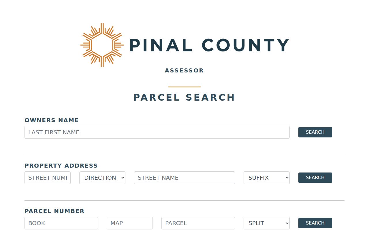
Its separate search modes show why one street line, an owner name, and a parcel reference should not be forced into the same field.
Map Pinal County by Street
The county Parcel Viewer turns one address into a street-by-street map. Its layer list includes parcels, building footprints, lot lines, surveys, subdivisions, street centerlines, cities, and township or section grids. Selection tools draw a point, rectangle, polygon, circle, or line. There is no enabled one-click buffer. To study a block, select only the road segment at issue and review every parcel that touches the shape.
Edge parcels deserve care because the map can include lots that only partly meet the selected shape. Print and measure tools help preserve research notes, but the county warns that boundaries are illustrative. A fence conflict, title question, or legal boundary needs a recorded survey or title work. The map is evidence of the assessment layer, not a survey.
- Parcel
- A tract identified on the county assessment roll by a parcel number.
- Situs address
- The physical site address, kept apart from the owner's postal address.
- Plat
- A recorded map that lays out lots, blocks, roads, and related survey detail.
- Criss-cross directory
- A historical directory ordered by street and house number rather than by surname.
Note: Parcel lines are strong search aids, but Pinal County expressly says the viewer is not a legal survey or title report.
Two Pinal County Address Views
Pinal County keeps the property site and the owner's postal contact as distinct facts. The Assessor and GIS expose the physical site. Treasurer Parcel Inquiry can search an owner and return mailing city, state, ZIP, parcel number, and tax details, with results that may be exported. Its data refresh nightly rather than in real time. A postal address can point to a post office box, a second property, a management office, or an older roll entry.
That contrast matters in a by-address search. Use situs fields to decide which lots sit along a road. Use the mailing field only as an official contact clue. Never move a parcel into another block because its owner receives mail elsewhere.
The Treasurer owner and mailing search is shown in this captured view.
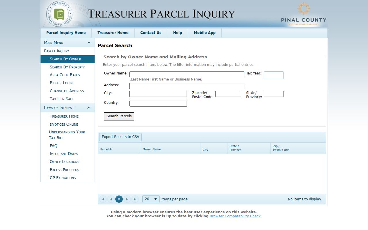
The form demonstrates that ZIP filtering describes owner mail, while a by-street study must remain tied to the parcel's site address.
Pinal County Street Record Layers
No Pinal County street directory holds every person. Each address-keyed record answers a narrower question. The Assessor identifies the party listed for a parcel, the Treasurer describes the tax account, the Recorder supplies instruments, and the correct planning office handles permits. Incorporated parcels go to their municipal custodian. Unincorporated sites normally go to Pinal County Community Development after GIS confirms jurisdiction.
| Address source | Custodian | Street evidence | Route and caution |
|---|---|---|---|
| Current parcel roll | Pinal County Assessor | Owner, site, postal address, legal description, characteristics | Free search/map; owner is not always occupant |
| Tax account | Pinal County Treasurer | Owner mail, tax years, bills and payments | Free, nightly updates; counter for older rolls |
| Deed and plat index | Pinal County Recorder | Named parties, instruments, legal continuity | Web images from May 23, 1980; office fallback earlier |
| Permit or code file | City or Pinal Community Development | Site, applicant, contractor, work and inspection dates | Portal or focused public-record request |
| Reverse directory | Library or archive | Historical subscriber or occupant by address | Coverage is title and year specific |
| Voter record | Recorder Elections / Secretary of State | Controlled registration evidence | Ordinary portal is self-service, not a block roll |
When no portal exposes the needed file, call or write the named custodian. Arizona law opens existing public records promptly, but it does not make an office build a new resident list. Supply the exact site address, parcel number, date span, and record series.
Follow Pinal County Street Deeds
A reception or fee number is the cleanest bridge from a parcel popup to the Pinal County Recorded Document Search. If it is absent, search the listed owner as a grantor or grantee, narrow by an approximate date and document type, then compare the legal description. Later deeds may cite an earlier fee number or book and page. Those references are safer than a typed street line when an address has changed.
The online index and images begin May 23, 1980. Images carry an unofficial-copy watermark, while an official copy costs $1 per page and certification adds $3 per document. Requests may go by email, mail, or counter. The Recorder also has satellite offices in Apache Junction, Casa Grande, Maricopa, and San Tan Valley. For an earlier instrument, give staff the newest known party, approximate date, legal description, and cited reference so they can direct the search into office indexes or microfilm.
A deed of trust is security, not a sale. A release deals with that security. Trustee, beneficiary, probate, merger, and entity transfers can also break a simple buyer-to-seller pattern, so the address trail must follow the instrument type as well as the names.
Check Pinal County Tax Parcels
The Pinal County Treasurer Parcel Inquiry provides a second official view of the parcel. It can confirm the tax account, owner mail, tax year, bills, payments, and delinquency status. Because its update schedule and purpose differ from the Assessor's map, small timing differences can occur. Compare both records before deciding that a name or address changed.
The official parcel inquiry entrance appears below.
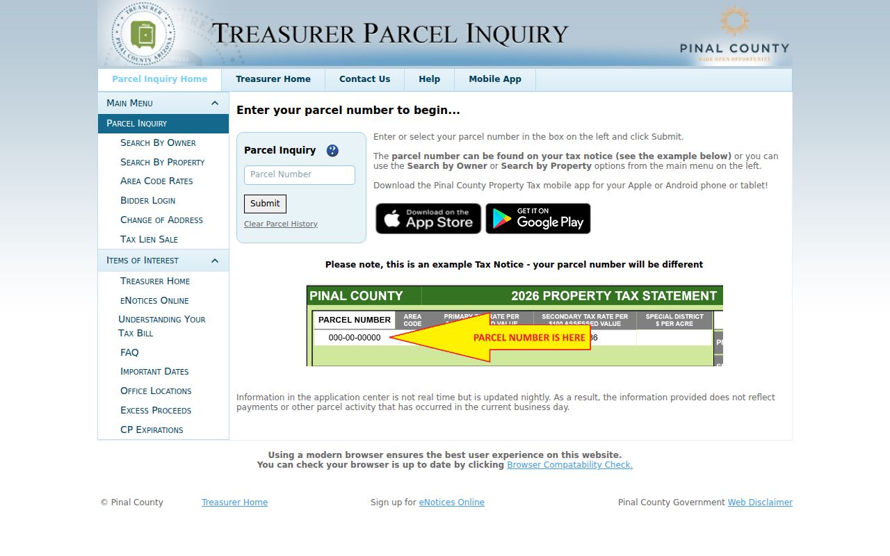
This account view can corroborate a parcel number and postal contact, but it still cannot identify everyone on the site.
Five Pinal County Street Grids
Pinal County does not use one countywide street-number scheme. The Addressing Ordinance identifies five grids: Pinal County, Apache Junction and Gold Canyon, Queen Valley, San Manuel, and Oracle. Four have a zero point. San Manuel does not. Directional prefixes follow each grid's baseline, so similar-looking numbers can refer to different local systems.
Jurisdiction adds another layer. Apache Junction, Casa Grande, Coolidge, Eloy, Florence, Maricopa, and other incorporated places keep their own permit channels. San Tan Valley is unincorporated. Tribal land requires the proper sovereign custodian rather than an assumption that county records tell the whole story. Search the parcel in GIS first, turn on the city boundary layer, and keep the legal description when street or postal labels conflict.
Pinal Streets Across ZIP Changes
Postal history can split one street search into two forms. On July 1, 2009, USPS changed several local codes from the 852 series to the 851 series, including shifts affecting Queen Creek-area, San Tan Valley-area, Red Rock, Stanfield, Superior, and related delivery codes. An old deed, phone book, or scanned notice can retain the prior ZIP even though the road did not move.
Search both ZIP forms for historical text and OCR, but anchor the lot with its parcel number and legal description. Postal names also cross government boundaries. A Queen Creek, Tucson, Laveen, Hayden, or Winkelman mailing label does not by itself prove a particular city or county. This geographic quirk is why the by-address chain begins with county GIS rather than a postal-city guess.
Older Pinal County Street Residents
Reverse and criss-cross directories can add an occupant or telephone subscriber between census years, but Pinal County has no verified continuous countywide run. Confirm a title and year through a Pinal County Library District member branch, Arizona Memory, State Archives, or the Pinal County Historical Museum. Read that volume's abbreviation key. A missing entry can mean an unlisted number, rural delivery, a spelling variant, or a gap in publication.
For a deeper look at publishers, known editions, telephone-book runs, and how entries were printed, use the Pinal County city directory collections. On the street page, those volumes serve one narrow role: they supply dated occupant evidence that land records cannot.
Pinal County Street Privacy Limits
A by-address roll cannot show every person inside a home. Parcel data names an assessed owner, not all residents. Private utility accounts, delivery data, and driver records do not become public rolls. A voluntary association list is not a compulsory county record. The Arizona Voter Information Portal lets a voter check personal status and districts, but it is not an open by-street search.
Arizona's Address Confidentiality Program supplies a substitute address for eligible victims. Related statutes can also protect voter, assessor, and recorder address information. Sealed files and withheld personal fields must remain closed. An apparent gap should never be treated as proof that someone did or did not live at a place.
Lawful use. Pinal County address records support lawful family, property, and civic research. Arizona law prohibits using public facts to stalk, harass, threaten, or harm anyone.